Olary Project
Cutana Tenement
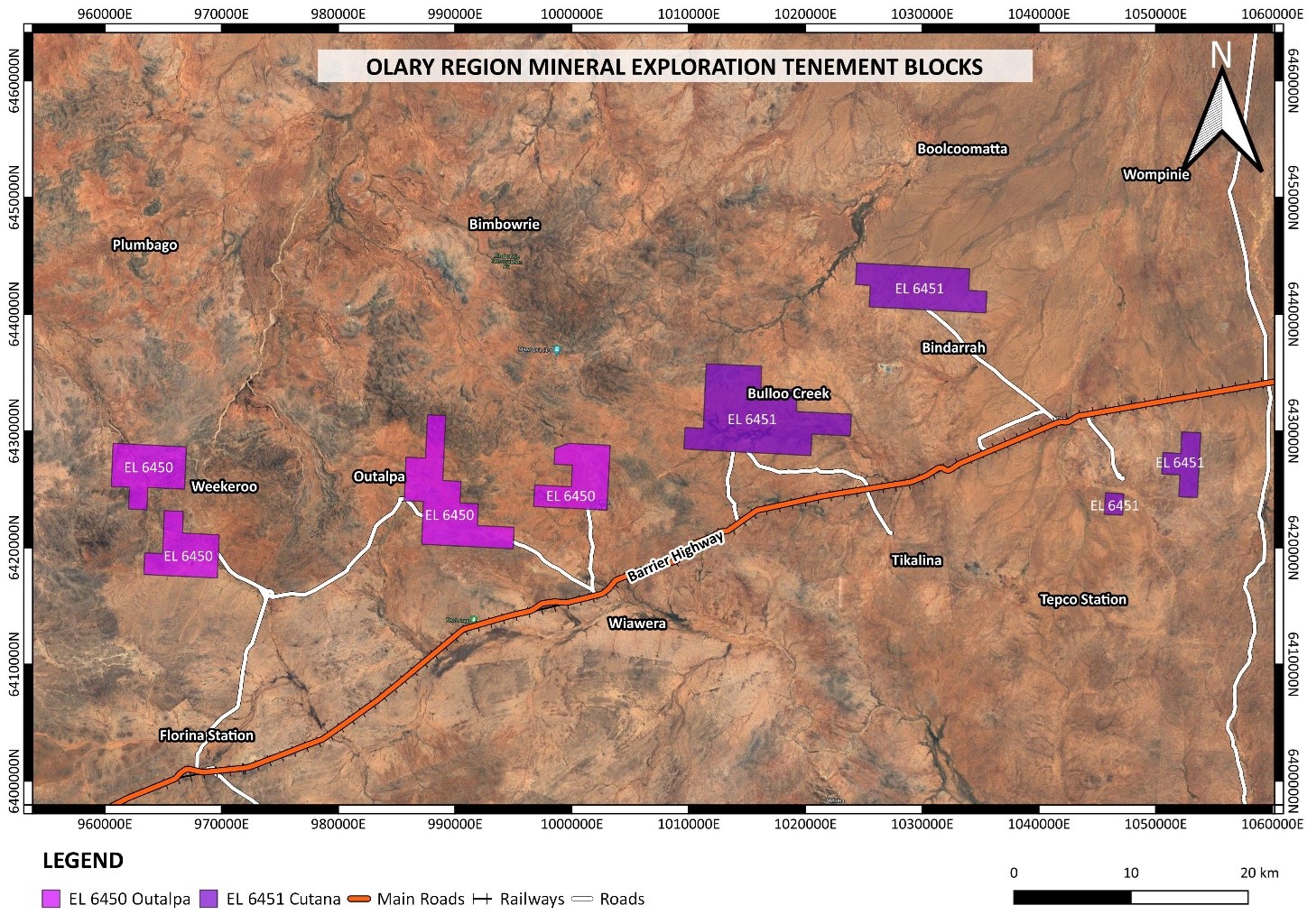
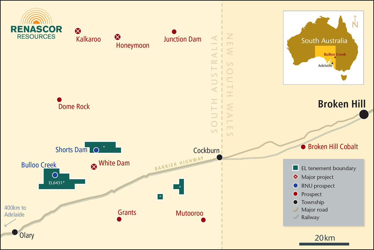
The Cutana tenement within the Olary Project area is about 350 km north-east of Adelaide, located within the Curnamona Province. The surrounding region hosts several significant mineral resources, all proximate to Renascor’s tenement. These include the Broken Hill mining hub, one of the largest historical base metals complexes in the world (100km east), the Kalkaroo copper-gold-cobalt project (45km north), the Mutooroo copper-cobalt-gold project (45km southeast), the Broken Hill Cobalt Project (75km east) and the White Dam gold mine (13km west).
Exploration at Cutana has historically primarily targeted gold extensions into Renascor’s project area from regional structures interpreted to control localisation and mineralisation of the nearby White Dam gold mine. Later efforts have also extended to cobalt/copper targeting, with promising indicators presenting at Bulloo Creek and Shorts Dam.
Bulloo Creek Prospect
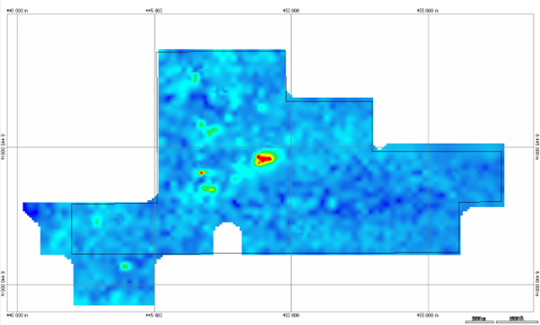
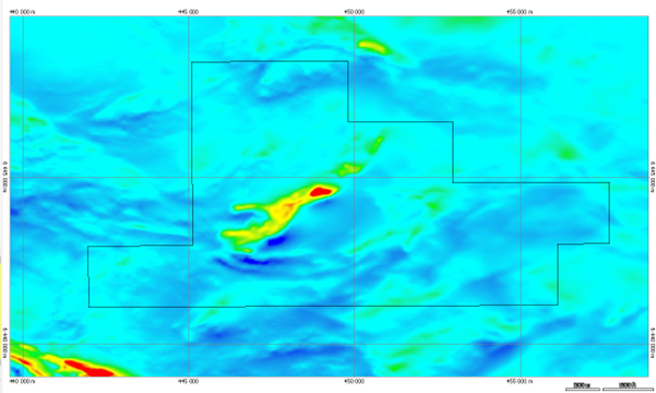
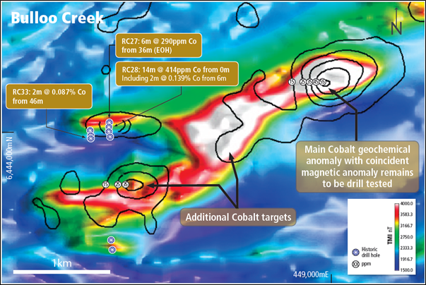
Bulloo Creek has been identified from extensive detailed soil geochemistry (Figure 3), with elevated Co soil geochemistry contours correlating with a magnetic high surveyed in the area (Figure 4). The close correlation of Co soil geochemistry and magnetics at Bulloo Creek is depicted in Figure 5.
Two Renascor RC drill sections previously testing a soil gold anomaly returned elevated Co near surface (see RC28: 14m @ 414ppm Co incl. 2m @ 0.139% Co, RC33: 46m – 48m @ 0.087% Co).
Coincident infill Co soil geochemistry compared to overlying magnetics contours has also been completed.
As a result, an extensive (3km) magnetic trend coincident with coherent Co soil anomaly presented as a highly prospective walk-up drill target.
Recent reinterpretation of geophysical data around the Bulloo Creek prospect in 2025 has since identified and refined a priority “Eastern Anomaly” zone, which is modelled to host three distinct near-surface magnetic bodies (tops of magnetic bodies are modelled to start from as shallow as 56 metres below surface), extending over a strike length of approximately 500 metres. These magnetic bodies remain closely correlated with the anomalous cobalt surface soil geochemistry results of up to 55 ppm Co.
An additional modelled magnetic body was also defined in the “Western Anomaly” zone. This magnetic body was not intersected by drilling previously undertaken in close proximity to this feature. However, downhole copper abundance was found to increase as drilling moved towards the modelled magnetic body nearby.
Given the precedents established for copper, cobalt and/or gold to be hosted together in significant resources nearby, Renascor considers that there are multiple indicators that suggest that the Bulloo Creek prospect may also be prospective for copper-cobalt-gold.
Figure 3. Regional Cutana cobalt soil geochemistry heat map at the Bulloo Creek Prospect.
Figure 4. Cutana Total Magnetic Intensity (TMI) imagery displaying the prominent magnetic high over the Bulloo Creek prospect.
Figure 5. Bulloo Creek prospect total magnetic intensity (TMI), overlain with cobalt soil geochemistry contours in parts per million (ppm). The main “Eastern Anomaly” zone contains the highest anomalous TMI (>4000 nT) and coincident Co surface geochemistry (55ppm Co). Notable cobalt intercepts from Renascor’s 2011 drilling campaign are also highlighted.
Shorts Dam Prospect
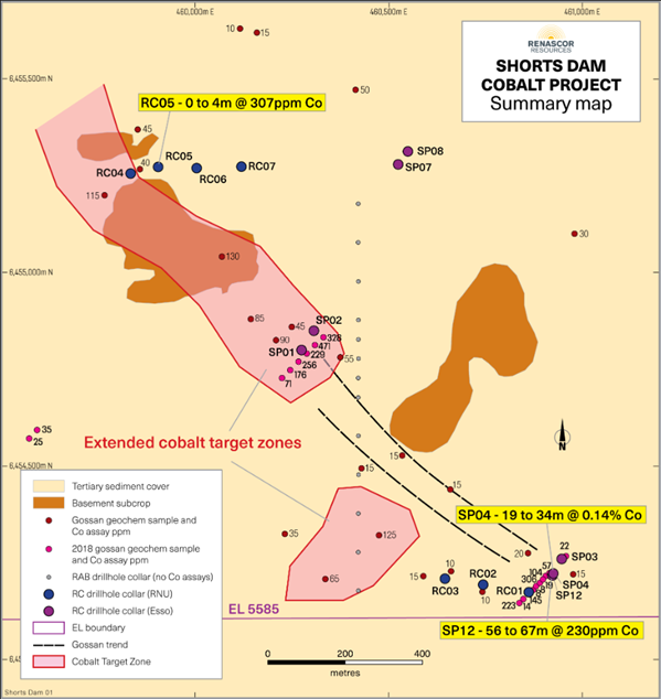
Gossan sampling and mapping by Esso Minerals in the 1970s defined an extensive zone of elevated Cu/Co gossans. Historical drill testing returned the following results:
-
-
- DH SP4: 15m at 0.14% Co from 19m, accompanying pyrrhotite and pyrite.
- Esso drillhole “SP4” deepened with “SP12” returned elevated Co and Cu associated with the “Bimba” sulphide unit.
- Hole SP3 failed to test the target down dip.
-
Subsequent Renascor gossan sampling confirmed a major NW target zone following the Bimba Unit trend.
Noting the Co association with pyrrhotite/pyrite and proximity to the Bimba Unit and related sulphide gossans, following the predicted Bimba Unit trend is viewed as a potential walk-up drilling target. A major NW trending target zone awaits testing (see Figure 6).
Outalpa Tenement
The Outalpa tenement within the Olary Project area resides approximately 25km west from Renascor’s Cutana tenement, about 350 km north-east of Adelaide.
In addition to significant resources noted within the Cutana tenement description, another important mineral deposit in this area is the Radium Hill uranium mine.
Renascor has performed systematic, multi-element soil sampling over limited portions of its 100%-owned Outalpa tenement. The sampling program, which was targeting uranium and copper, showed limited responses for these minerals, however, several elevated gold zones were detected. Given the favourable results from the sampling program over the Cutana tenement, which is located in a similar geologic setting and within 25 kilometres of the Outalpa tenement, Renascor believes the Outalpa tenement could yield similarly prospective gold, copper or cobalt targets.
Lithium potential is also noted given the extensive pegmatites within the tenement.

